Egypt

Egypt
Egypt lies primarily between latitudes 22° and 32°N, and longitudes 25° and 35°E. At 1,001,450 square kilometres (386,660 sq mi) ,it is the world's 30th-largest country. Due to the extreme aridity of Egypt's climate, population centres are concentrated along the narrow Nile Valley and Delta, meaning that about 99% of the population uses about 5.5% of the total land area. 98% of Egyptians live on 3% of the territory.
Photos from my trips to Egypt between 2000 and 2003.
The Great Pyramids of Giza


Inside the Pyramid of Khufu (2001)


Cairo
Cairo is the capital of Egypt. The city's metropolitan area is one of the largest in Africa, the largest in the Middle East, and the 15th-largest in the world, and is associated with ancient Egypt, as the famous Giza pyramid complex and the ancient city of Memphis are located in its geographical area. Located near the Nile Delta, modern Cairo was founded in 969 AD by the Fatimid dynasty, but the land composing the present-day city was the site of ancient national capitals whose remnants remain visible in parts of Old Cairo.
With a population of over 9 million spread over 3,085 square kilometers (1,191 sq mi), Cairo is by far the largest city in Egypt. An additional 9.5 million inhabitants live in close proximity to the city. Cairo, like many other megacities, suffers from high levels of pollution and traffic.

The Saladin Citadel of Cairo is a medieval Islamic fortification in Cairo, Egypt. The location, on Mokattam hill near the center of Cairo, was once famous for its fresh breeze and grand views of the city. It is now a preserved historic site, with mosques and museums. In 1976, it was proclaimed by UNESCO as a part of the World Heritage Site Historic Cairo (Islamic Cairo) which was "the new centre of the Islamic world, reaching its golden age in the 14th century."


Saqqara
Saqqara also spelled Sakkara or Saccara in English, is a vast, ancient burial ground in Egypt, serving as the necropolis for the Ancient Egyptian capital, Memphis. Saqqara features numerous pyramids, including the world-famous Step pyramid of Djoser, sometimes referred to as the Step Tomb due to its rectangular base, as well as a number of mastabas (Arabic word meaning 'bench'). Located some 30 km (19 mi) south of modern-day Cairo, Saqqara covers an area of around 7 by 1.5 km (4.35 by 0.93 mi).
At Saqqara, the oldest complete stone building complex known in history was built: Djoser's step pyramid, built during the Third Dynasty. Another 16 Egyptian kings built pyramids at Saqqara, which are now in various states of preservation or dilapidation. High officials added private funeral monuments to this necropolis during the entire pharaonic period. It remained an important complex for non-royal burials and cult ceremonies for more than 3,000 years, well into Ptolemaic and Roman times.

The stepped Pyramid of Djoser at Saqqara


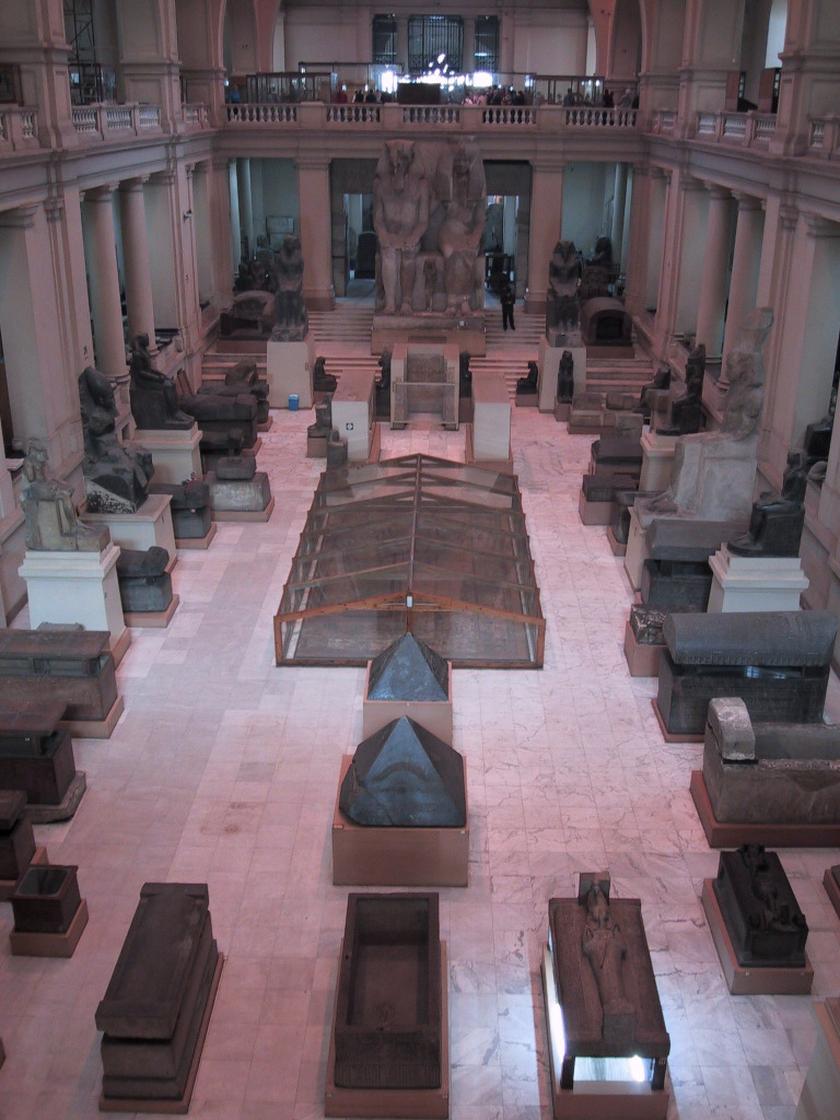
Museum of Cairo


The mask of Tutankhamun is a gold death mask of the 18th-dynasty ancient Egyptian Pharaoh Tutankhamun (reigned 1332–1323 BC). It was discovered by Howard Carter in 1925 in tomb KV62 and is now housed in the Egyptian Museum in Cairo. The mask is one of the most well known works of art in the world.
The Gold Mask of Tutankhamun, composed of 11 kg of solid gold

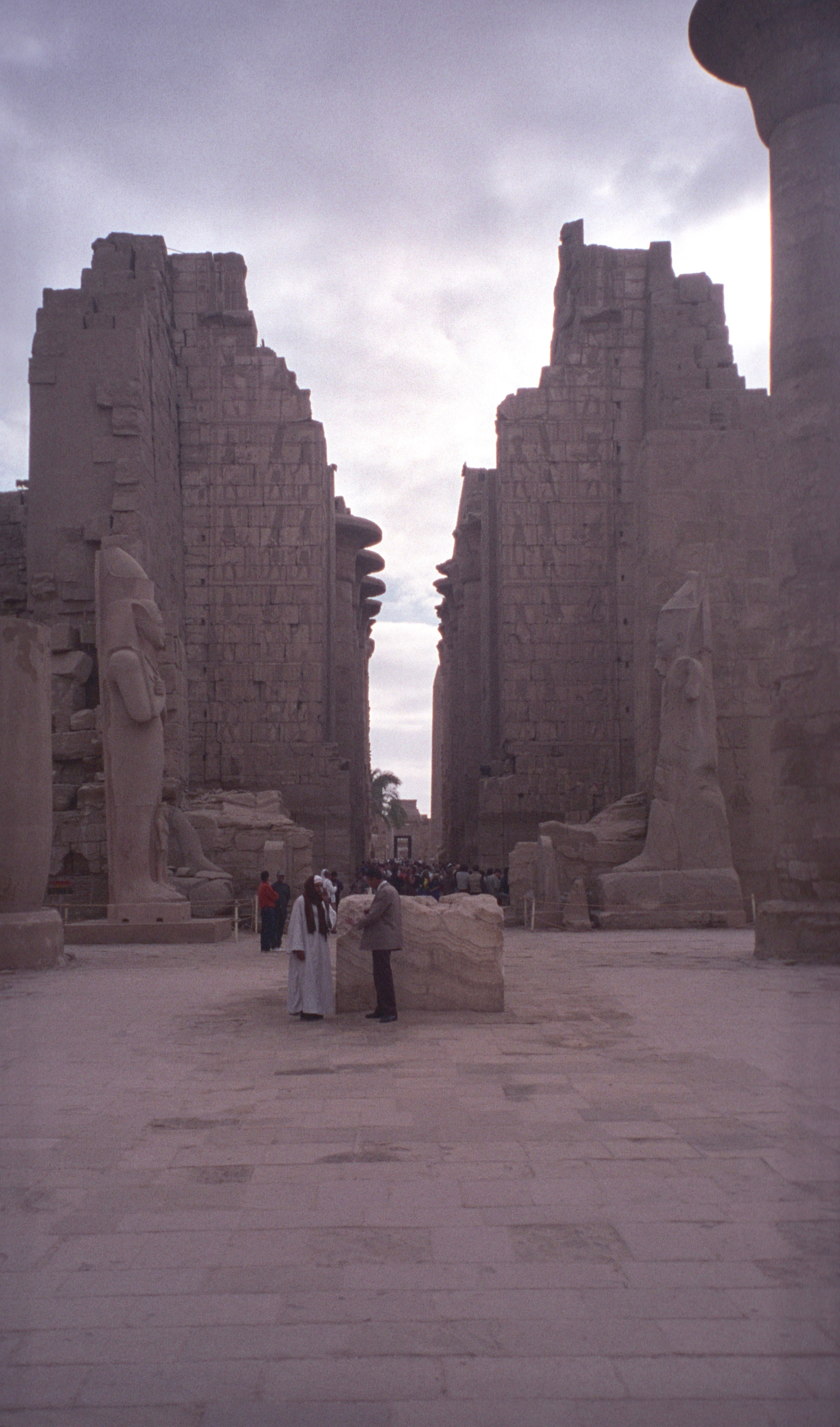
Luxor
Luxor is a city in Upper (southern) Egypt and the capital of Luxor Governorate. The population numbers 506,588 (2012 estimate), with an area of approximately 417 square kilometres (161 sq mi).
As the site of the Ancient Egyptian city of Waset, known to the Greeks as Thebes, Luxor has frequently been characterized as the "world's greatest open-air museum", as the ruins of the temple complexes at Karnak and Luxor stand within the modern city. Immediately opposite, across the River Nile, lie the monuments, temples and tombs of the West Bank Necropolis, which includes the Valley of the Kings and Valley of the Queens.


Valley of the Kings
The Valley of the Kings is a valley in Egypt where, for a period of nearly 500 years from the 16th to 11th century BC, rock cut tombs were excavated for the pharaohs and powerful nobles of the New Kingdom (the Eighteenth to the Twentieth Dynastiesof Ancient Egypt).
The valley stands on the west bank of the Nile, opposite Thebes (modern Luxor), within the heart of the Theban Necropolis. The wadi consists of two valleys, East Valley (where the majority of the royal tombs are situated) and West Valley.


